| What is geocoding? |
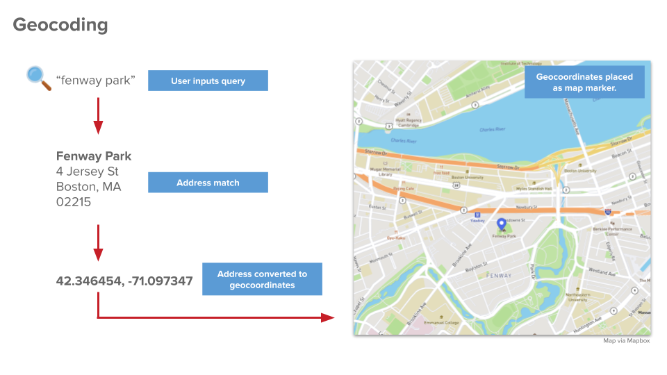
Geocoding is the process employed to convert the textual description of a location, such as a street address, to an absolute location with latitude and longitude coordinates that can be plotted on a map. Alternatively, it is the computational process by which a physical address is converted into geographic coordinates, which can be used for a variety of mapping applications.

Locations are not only denoted by XY coordinates. They can also be described by be a street name and number, the name of a city, province, or country or natural features, such as a drainage basin or ecological region. Geocoding is the process employed to convert the textual description of a location, such as a street address, to an absolute location with latitude and longitude coordinates that can be plotted on a map.
A spatial join is the operation used to match values of one table to the attribute table of a pre-existing spatial feature class. This method gives one the non-spatial data geographic context. It is crucial to the geocoding procedure and is discussed further in depth in the Geocoding guideline developed by the Geospatial Analytics unit in the eRKU.

